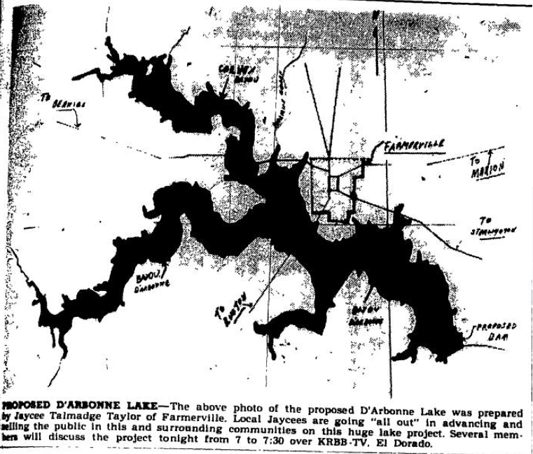
This is pretty cool. It’s an early rough proposal map of Lake D’Arbonne from the front page of the Farmerville Gazette in 1956. It was eight years later when the spillway gates were closed and the 16,000 acre lake formed.
This is the first graphical idea that residents had of how the lake would be shaped. Thanks to Burt Green for “digging this up” and sharing it on his Union Parish History Facebook Page. You can learn more about that at:
https://www.facebook.com/groups/UPHistory/?fref=nf
The map was prepared by a member of the Jaycees, Talmadge Taylor. That group and area elected officials were instrumental in getting the lake from an idea to reality. I just have one thing to say to them:
Thanks!


Discussion
No comments yet.